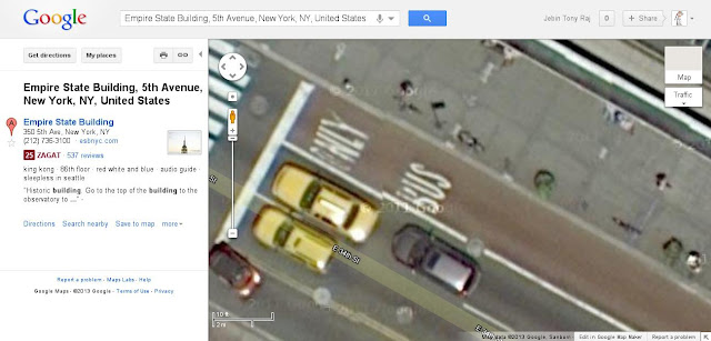
Google maps allows you to have a closer look at its mapped locations but it has also got a hidden feature which allows you to look much more closer than it is normally allowed. Here’s the way to do so.
- Open Google Maps and go to a location you want.
- Zoom in as much you can by clicking the “+” sign of the magnification slider in the left side of the map. But don’t zoom in all the way to street view (if the location has got one).
- Look at the top left side of the map where you have got a printer and chain link button. Click on the chain link button.
- It will provide you with an URL and an HTML embed code.
- Copy the URL and paste it in the address bar of your browser but DO NOT hit enter.
- Instead scroll all the way to the right end of the URL (you can use the END key).
- It should end with something like “&z=22”. Change the 22 to 23 ("&z=23") and hit enter. If Google Maps has imagery at that higher zoom level, it will show it to you.
